|
Flood Insurance Rate Map
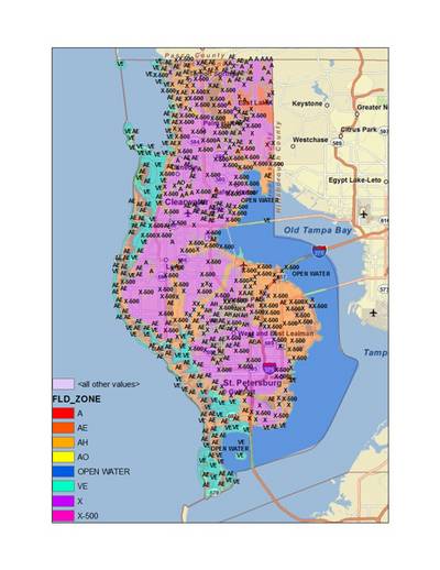
Flood Insurance Rate Map (FIRM) for Pinellas County, FL. Different flood zones, based on the 1% annual chance flood, are shown on this map. Zone X (purple colors) indicates moderate flood areas outside the limits of the base flood (0.1% or 100-year flood) and the 0.2% annual chance (or 500-year) flood. X-500 zones (bright pink colors) indicate the areas between the limits of the base flood and the 0.2% annual chance flood. VE (turquoise) and AE (orange) zones are considered high-risk areas, or Special Flood Hazard Areas (SFHAs).
|
|