 |
Katrina Impacts |
 |
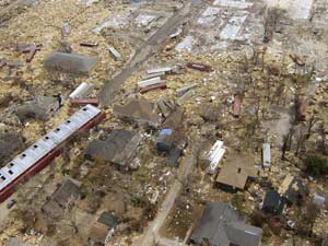
 Photo of debris and house foundations in Biloxi Mississippi following Katrina. NOAA. |
On August 26, 2005, both Louisiana and Mississippi activated their emergency response plans and began preparations for evacuations along the coast. Most people evacuated from coastal Mississippi and Louisiana. Many people who did not were unable to for medical reasons or had limited access to transportation. It is estimate that around 1.2 million people evacuated the metropolitan New Orleans region and that about 100,000 people remained in New Orleans. Of those remaining, around 10,000 went to the Superdome shelter before the storm.
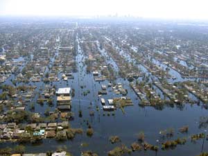
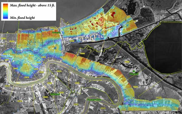
When the waves and storm surge hit the coastline, the structures along the coast in Mississippi were completely destroyed and further inland experienced catastrophic flooding. In New Orleans, the combination of surge and waves lead to failure and overtopping of the levee system. More than 50 breaches of the levee system lead to flooding that eventually covered 80% of the city of New Orleans to depth above 15 ft. in some places. Because the city of New Orleans is mostly below sea level, and most of the pump stations used to remove rain water from the city were disabled by the storm, the water stayed in the city.
 Photo of the flooding in New Orleans following Katrina.NOAA. |
Overall, more than 1,800 people lost their lives as a result of Hurricane Katrina. More than 1,500 death occurred in Louisiana, around 230 in Mississippi, and 14 in Florida. Katrina is the third deadliest hurricane in U.S. history. In New Orleans, people were trapped in their houses and on their roofs as the rapidly rising water caught many people by surprise. The flooding and widespread damage from Katrina delayed rescue and aid efforts for days. Besides the death toll, hurricane Katrina left many people homeless as more than 800,000 housing units were destroyed or damaged in the storm. Katrina is the costliest U.S hurricane, with estimated damage over $81 billion and costs over $160 billion (2005 US dollars).
 Map of New Orleans showing flooding depths. Maximum depths are above 15 feet. From the US Army Corp of Engineers IPET report. |
|
|
 |