
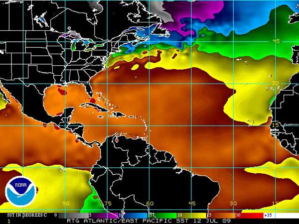
Sea surface temperature (SST) is an important factor in hurricane dynamics. SST is measured over large portions of the ocean by satellites.
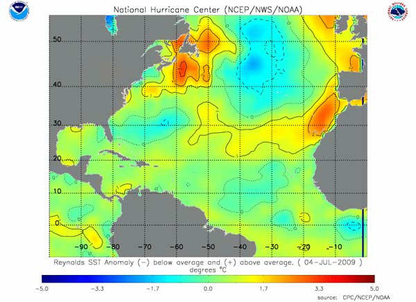
Sea surface temperatures are generally warmer at low latitudes and colder at high latitudes but SST will vary with the seasons and with surface ocean currents. For forecasting hurricanes, more detailed maps of SST are produced for areas of hurricane formation. Scientists used more refined data that is a blend of the satellite and in-situ instrument data to produce the high-resolution SST analysis, such as the Reynolds analysis image below.
For hurricane forecasting, it can also be very useful to look at the SST anomalies. A SST anomaly is the difference in the current SST measurement from the long-term average temperature for a given month, in a given place (the climatology). Positive temperature anomalies indicate that the water is warmer than usual and negative anomalies indicate that the water is cooler than usual.
The vertical temperature distribution in the ocean is also important for understanding hurricane dynamics. While satellites can measure the surface ocean temperature over large areas rapidly and repeatedly, measuring the temperature through the water column requires a fixed buoy with instruments or a ship that can deploy instruments in a specific area. There are also instruments that can be deployed from a plane. The temperature profile through the water column is variable and will change seasonally, as the mixed-layer changes, and as storms pass over. The warm water is present at much deeper depths in the Caribbean Sea than in the Gulf of Mexico. |

 |
Please address comments and questions to hurricane@etal.uri.edu