
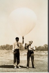
Since the late 1930s, upper-air observations have been made by the US. Weather Bureau and its current name – the National Weather Service (NWS) - using balloon-borne radiosondes. While these instruments are essentially “bottom-up” dropsondes and are not typically used to measure hurricanes directly, radiosondes provide important upper-air data that are essential for weather forecasts and research. Radiosonde data also provide a ground-truth for satellites data. The radiosonde is a small, expendable instrument that is suspended 25 m (about 80 ft) or more below a large balloon. As the radiosonde rises at about 300 m/min (about 1,000 ft/min), its sensors make in-situ measurements of pressure, temperature, and relative humidity in the air. Data on wind speed and direction aloft are also obtained by tracking the position of the radiosonde in flight (observations where winds aloft are also obtained from radiosondes are called "rawinsonde" observations). All data are sent to a tracking antenna located on the ground. The radio signals received by the tracking antenna are converted to meteorological values and transmitted to forecasters and researchers.
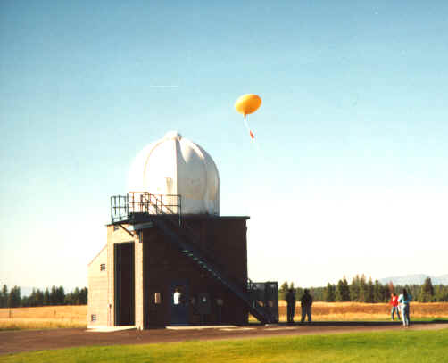
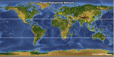
The radiosonde flight can last in excess of two hours, and during this time the radiosonde can ascend to over 35 km (about 115,000 ft) and drift more than 300 km (about 180 mi) from the release point. During the flight, the radiosonde is exposed to temperatures as cold as -90°C (-130°F) and an air pressure that is only a few thousandths of what is found on the Earth's surface. If the radiosonde enters a strong jet stream it can travel at speeds exceeding 400 km/h (250 mph). The balloon that is attached to the radiosonde is filled with either helium or hydrogen gas. When released, the balloon is about 2 m (about 6 ft) in diameter and gradually expands as it rises. When the balloon reaches a diameter of 6 to 8 m (20-25 ft) in diameter, it bursts. A small, colored parachute slows the descent of the radiosonde. At the present time, data are not collected while the radiosonde descends. Worldwide, there are over 800 radiosonde observation stations. Most of these stations are located in the Northern Hemisphere and all observations are usually taken at the same time each day (00:00 and/or 12:00 UTC), 365 days a year. When severe weather is expected, additional soundings may be taken during the day at a select number of stations. The NWS Upper-Air Observation Programs collects data via 92 radiosonde stations - 69 in the 48 contiguous states of the U.S., 13 in Alaska, 9 in the Pacific, and 1 in Puerto Rico. The NWS also supports the operation of 10 other stations in the Caribbean. Due to funding and resource limitations, however, not all radiosonde stations provide twice-daily 365 days a year soundings. Some are only launched once a day and some are only launched during the peak weather season (ie., hurricane season in the Caribbean).
|
 |
Please address comments and questions to hurricane@etal.uri.edu