
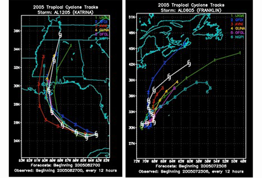
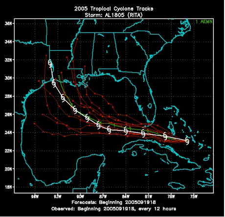
It is impossible to definitively predict the future state of the atmosphere because of its chaotic nature. Furthermore, existing observation networks have limited resolution in both space and time, especially over large bodies of water such as the Pacific Ocean. Lack of observations introduces uncertainty into the true initial state of the atmosphere. To account for this uncertainty, "ensemble" forecasting is used, involving multiple forecasts created with different models, different physical parameterizations, or varying model initial conditions. Consensus forecasts are obtained by combining the forecasts from a collection (or “ensemble”) of models, where the ensemble can consist of either multiple forecasts from a single model or forecasts from different, models. The simplest way to form a consensus is to average the output from each member of the ensemble. At the National Hurricane Center (NHC), some of the more commonly used consensus forecasts are called GUNA, TVCN, FSSE, and ICON. On average, consensus forecasts are more accurate than the predictions from the individual ensemble members. The variation or spread of the ensemble members (seen in the figure below) can provide a measure of forecast uncertainty.
Taking the consensus approach a step farther, “corrected” consensus models assign different weights to each individual model in an attempt to account for biases in each model. A model bias occurs when a particular forecast parameter is consistently wrong in the same direction after the model has been used to forecast many storms. For example, if a model consistently produces a track forecast that is too far to the left, it is said to have a “left-track bias.” If a model consistently produces an intensity forecast that is too high, it is said to have a “high-intensity bias.” One limitation of the “corrected” consensus technique occurs when the past performance of the individual models does not accurately represent their present performance (for example, if major changes are made to an individual model between successive hurricane seasons). Some of the commonly used “corrected” consensus forecasts at NHC include FSSE, TVCC, and TCCN. In a single-model ensemble, one model is used to make multiple predictions. The only difference among the ensemble members is that the initial condition is changed from one member to the next. This type of ensemble accounts for the uncertainties in the model initial condition. Even among single-model ensembles, a simple average of the individual model forecasts (the ensemble mean) often produces a more accurate forecast than any single model forecast because errors associated with the individual forecasts tend to be cancelled out. However, the ensemble mean often smoothes out the finer-scale details within the individual model forecasts. In most cases, the ensemble forecasts are made at relatively low resolution compared to the parent model for computational efficiency.
|
 |
Please address comments and questions to hurricane@etal.uri.edu