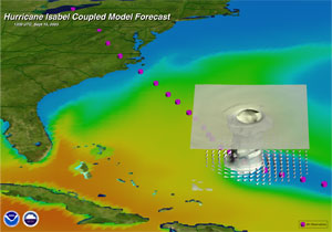
A hurricane forecast model can be defined as any objective tool, usually based on mathematical equations, that is designed to predict the future behavior of a hurricane (or more generally, any tropical cyclone). The primary purpose of a hurricane forecast model is to predict a hurricane’s track and/or intensity (and sometimes rainfall) for the next 3-5 days (although longer lead times are possible). Other forecast models are designed specifically to forecast the impacts of hurricanes, such as storm surge. Hurricane forecast models vs. hurricane research models
Like any other computer software program, a hurricane forecast model is written using one or more computer languages. Depending on the complexity of the model and the speed of the computer (or supercomputer) on which it is processing, the model may require anywhere from less than a second to a few hours to produce a hurricane forecast. Some models are so complex (or so detailed) that they take even longer to produce a forecast on fast supercomputers; these models can only be used for researching past hurricanes because the computer cannot produce the forecast until after the hurricane has passed the forecasted location. To differentiate these models from hurricane forecast models, they are often classified as hurricane research models, although hurricane forecast models can also be used for researching past hurricanes. Moreover, a complex hurricane research model may eventually become a hurricane forecast model when supercomputers are developed with a larger number of processors and faster processing speeds. Also, some hurricane research models are intentionally designed to be less complex to enable a researcher to isolate the impact of some physical processes on a hurricane without accounting for other potentially important physical processes; these models are not intended for producing accurate forecasts. Hurricane research and forecast models are developed primarily for making 3-5 day forecasts, but they can also be used in conjunction with climate models to project future hurricane activity. Hurricane Forecast Models
|


