
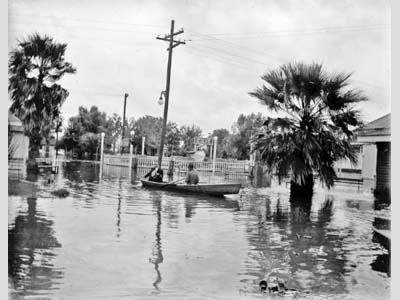
The Florida Keys Hurricane, sometimes referred to as the Atlantic Gulf hurricane, was first detected on September 1, 1919 as a tropical wave near the Lesser Antilles. At first, the system was poorly organized as it lacked low-level circulation. It did, however, become organized enough to be declared a tropical depression on 2 September while centered off of Guadeloupe. Traveling northeastward, the system became a tropical storm the next day southeast of Puerto Rico. On 4 September, the southwestern tip of the island experienced 80 kph (50 mph) winds as the storm passed by. For two days, the tropical storm paralleled the northern coastline of Hispaniola. By 7 September, the system strengthened into a Category 1 hurricane on the Saffir-Simpson Hurricane Wind Scale while located over the Bahamas. From that point, the hurricane intensified quickly as it moved westward through the archipelago. By 8 September, while off of the Bahaman island of Andros, the hurricane reached Category 3 status. The next day it became a Category 4 hurricane just before entering the Florida Straights. For four days, the system battered the keys with gusts up to 130 kph (80 mph), moving at a slow forward speed around 6 kph (4 mph). Nearly every structure in the Keys acquired some amount of damage. The hurricane also caused the sinking of 10 ships in the Florida Straits as it moved through. About 500 lives were lost on these ships, 488 on one vessel alone. Peak intensity of 240 kph (150 mph) winds was attained early on 10 September near Key West.
The powerful hurricane began to weaken once it entered the Gulf of Mexico, downgrading to Category 3 status by 12 September. The following day, however, the storm began to re-strengthen. Though it was brief, only remaining at this new peak intensity for 30 hours, the hurricane attained Category 4 winds of 230 kph (145 mph) early on 13 September. Later that day it did weaken back to Category 3 status. Late the next day, the hurricane made landfall on Texas between Brownsville and Corpus Christi as a Category 3 storm with winds of 185 kph (115 mph) and a storm surge as high as 16 feet. The system quickly weakened upon its contact with land, downgrading to tropical depression status only about 24 hours after landfall. All tropical characteristics were lost by 16 September. The hurricane inflicted serious damage to the city of Corpus Christi. The storm surge destroyed many buildings in the downtown area, where some debris piles reached 20 feet in height. Port Aransas, directly across Corpus Christi Bay on nearby Mustang Island, which was fully swept over by the storm surge, also received significant damage. There, great amounts of oil covered everything in and along the sides of the bay after storage tanks were breached. Many of the city’s principle buildings were pulled into the Gulf from the force of rushing water. Additionally, as many as 1500 cattle were lost as they were driven off land. Though the official death toll in the Corpus Christi area was 287, it is widely believed that the actual number of lives lost could exceed 600; therefore the true death toll remains somewhat a mystery. Some believe officials downplayed the true number of lives lost in an attempt to not hinder the upcoming major development of industry and residences in the area. Total storm damages totaled $22 million (1919 USD) with at least 750 killed. Fast Facts:
Sources:
Monthly Weather Review. Weather Bureau. Sep. 1919. Web. Roth, David. “Texas Hurricane History.” National Weather Service. 14 Jan. 2010. Pp. 37-38. Keim, Barry D. and Robert A. Muller. Hurricanes of the Gulf of Mexico. Baton Rouge: Louisiana State University Press, 2009. Pp. 150. Barnes, Jay. Florida’s Hurricane History. Chapel Hill: UNC Press, 1998. Pp 99-102. “1919 Florida Keys Hurricane.” Wikipedia. 2010. Web. |
 |
Please address comments and questions to hurricane@etal.uri.edu