
The National Oceanic and Atmospheric Administration (NOAA) operates two sets of satellites to monitor the weather. The geostationary satellites (geostationary operational environmental satellites - GOES) and low Earth orbit satellites. The GOES satellites circle the Earth in a geostationary orbit above the equator which means that they hover continuously over one place on the Earth’s surface. Animation of a geosynchronous orbit. Notice that the satellite stays above the same point on Earth as the Earth rotates. NOAA Satellite and Information Service. The GOES satellites orbit approximately 35,000km above the Earth (~ 22,000 miles), which gives them a full-disc view of the Earth. There are always two GOES satellites in operation, one over the US east coast - GOES East - and one over the US west coast - GOES West. Between them they can provide images for the whole U.S. In addition, they provide good coverage for the areas of the ocean where tropical cyclones typically form. In case one of these satellites fail, there are spare GOES satellites currently in orbit.
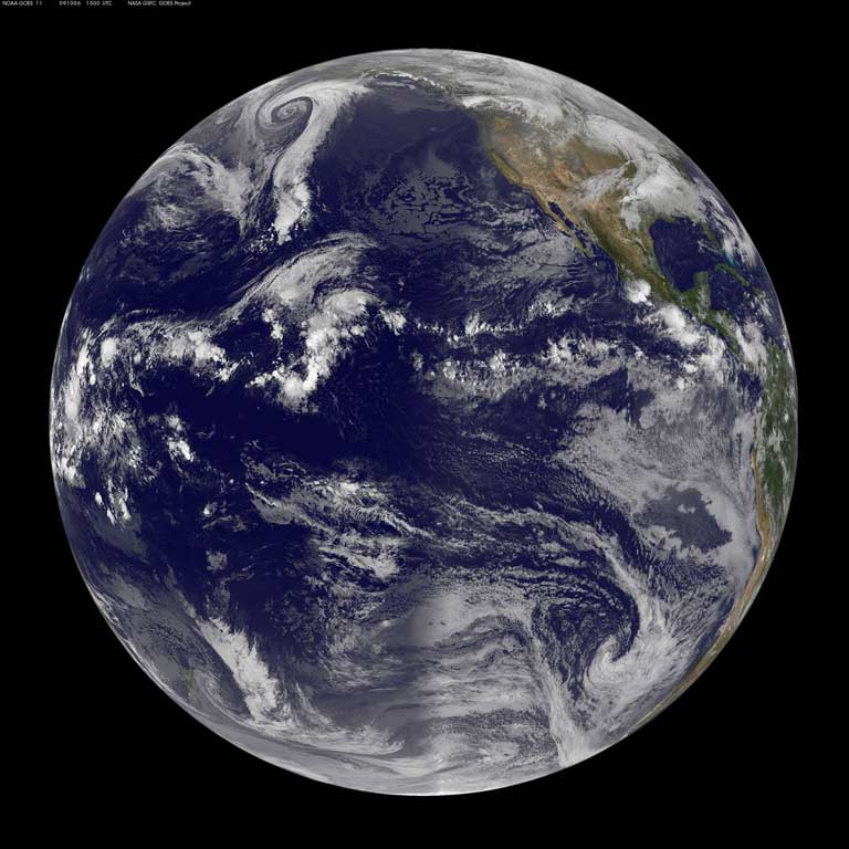
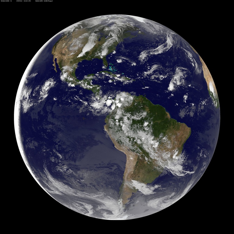
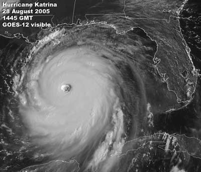
Since they are in a geostationary orbit, the GOES satellites provide continuous monitoring of the Earth’s surface. They are able to constantly monitor the life cycle of significant weather such as hurricanes, tornadoes, flash floods, and hail storms. The GOES satellites help monitor tropical cyclone development and track storm movements. GOES instruments are also used to estimate rainfall, snow cover, and track ice development. There are two primary instruments on the GOES satellites, the Imager and the Sounder. Both are passive sensors. The Imager collects radiant energy and reflected solar energy from the Earth's surface and atmosphere. The Sounder provides data to determine the vertical temperature and moisture profile of the atmosphere, surface and cloud top temperatures, and ozone distribution. The Imager can scan a 3,000 km x 3,000 km box on the surface of the Earth in about 41 seconds at resolutions of 1 to 8 km. In normal operating mode, GOES is capable of capturing detailed imagery of selected regions every 30 minutes. In rapid-scan mode, however, GOES collects imagery every 8 minutes (with the capability to capture imagery every 1 minute). This functionality is used when there is significant weather. The GOES imagery is very useful for modeling and forecasting tropical storms. Imagery from the GOES satellites is shown below:
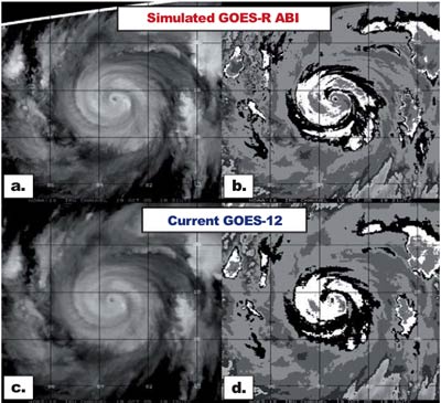
The next generation of GOES satellites (GOES-R) are already in development for launch in 2015. Compared to current GOES satellites, the GOES-R will:
The improved data and imagry from the GOES-R should aid in making better hurricane forecasts.
|
 |
Please address comments and questions to hurricane@etal.uri.edu