 |
1961- Hurricane Carla |
|
Hurricane Carla developed from a tropical depression that formed in the western Caribbean Sea on September 3, 1961. The depression moved northwestward for several days becoming a tropical storm on 5 September and a hurricane the day following. Hurricane Carla was a Category 1 hurricane as it briefly moved northward and then northwestward, skimming Mexico’s Yucatán Peninsula. After entering the Gulf of Mexico, the hurricane very steadily strengthened as it continued its slow northwest trek to the Texas coast. Peak intensity was reached on 11 September when winds topped out at 282 km/h (175 mph) – a strong Category 5 hurricane on the Saffir-Simpson Hurricane Scale. Hurricane Carla made landfall that day, but weakened to a strong Category 4 hurricane just prior. It made landfall in the Port O’Connor-Port Lavaca area of Texas as “one of the largest, most intense and destructive hurricanes ever to strike the United States Gulf coast,” according to the hurricane center located in New Orleans.
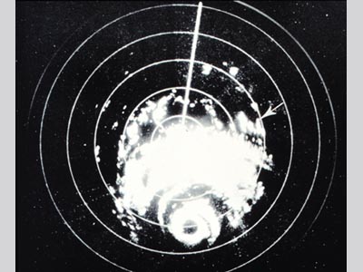 A radar display showing Hurricane Carla. In times before satellites, devices such as radar were useful in tracking storms. |
The Texas coast first began experiencing rough wave action three days before the hurricane’s landfall with increasing ferocity until the storm’s center, which brought a 6.7-meter (22 ft) storm surge, passed. The storm surge pushed as far as 16 km (10 m) inland and inundated 1.7 million acres with water. Hurricane conditions were experienced for an extended amount of time due to the storm’s slow movement of 9-14 km/h (6-9 mph). The slow movement was also responsible for high rainfall totals, the highest in Bay City, Texas at about 44.5 cm (17.5 in). Much of the destruction caused by the hurricane occurred away from the point of landfall, with damage reports coming from as far away as Dallas and as far east as the Mississippi River delta. The outbreak of 26 tornadoes by the storm was responsible for considerable damage, with one F4 tornado actually moving through downtown Galveston. Hurricane Carla caused $3.25 million (1961 USD) in damage, two-thirds of which was property damage and one-third crop damage – especially to the cotton crop. In Texas, about 2,900 buildings were destroyed and 10,000 others severely damaged. Port O’Connor was three-fourths destroyed.
Fast Facts:
- At the time, Hurricane Carla was the largest hurricane ever recorded in the Atlantic basin. To put this into perspective, consider the wind field at landfall. Sustained hurricane force winds were experienced between Galveston and Corpus Christi - roughly 400 km (250 mi) apart. The entire Texas coastline endured hurricane force gusts during the hurricane’s landfall.
- The death toll from the hurricane was 46 persons. This is quite low considering the size and power of the hurricane and the low elevation land on which it came ashore. The low numbers can be attributed to the successful evacuation of between a quarter and a half million people from the Texas coastline. At the time, this was the largest evacuation in U.S. history. However, in 2005 a much larger evacuation of the same coastline would ensue in advance of Hurricane Rita with 3 million people fleeing the approaching storm.
- The first live television broadcast of a hurricane from the location experiencing it was during Hurricane Carla by the famous Dan Rather.
Sources:
Dunn, Gordon E. “The Hurricane Season of 1961.” Monthly Weather Review. Mar. 1962. Pp 111-113. Web.
“Hurricane Carla.” Wikipedia. 2010. Web.
Roth, David. “Texas Hurricane History.” National Weather Service. 14 Jan. 2010.
|
|

