
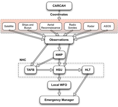
The National Hurricane Center (NHC) is responsible for forecasting all tropical cyclone activity in the Atlantic and Eastern Pacific basins around North America. The NHC forecasts the track, intensity, size, and structure of tropical cyclones, storm surges, rainfall, and tornadoes associated with tropical cyclones, and the likelihood of tropical cyclone formation within 48 hours. The overall skill of these forecasts is shown in the section on Hurricane Forecast Model Accuracy. Once a tropical cyclone forms, NHC staff follows a set of procedures to generate a set of forecast products and then communicate those products outside of NHC every six hours. While the NHC forecast process is the focus here, other agencies responsible for tropical cyclone forecasting in other ocean basins [link to Hurricane Forecast Regions and Centers] follow similar procedures, but their procedures are tailored to the needs of their areas of responsibility and are guided by the observational, modeling, and forecast dissemination capabilities of those areas. The NHC hurricane forecast process begins with available observations. Satellites, reconnaissance aircraft, Ships, buoys, radar, and other land-based platforms are important tools used in hurricane tracking and prediction. While a tropical cyclone is over the open ocean, remote measurements of the storm’s intensity and track are made primarily via satellites. Forecasters use satellite data to estimate characteristics of a storm, including the location of its center, its past motion (within 6-12 hours), and its intensity (maximum wind speed). Atlantic and Pacific Geostationary (GOES) satellites can continuously observe hurricanes from their formation to dissipation. Once an Atlantic hurricane becomes a threat to land, it is directly monitored by U.S. Air Force and NOAA hurricane aircraft, dropsondes, and land stations. Another aircraft that has been tested in monitoring hurricanes is the NASA Global Hawk, a large unmanned aircraft. The Global Hawk is an experimental aircraft that will be utilized again in coming hurricane seasons to help demonstrate possible operational capabilities. The Chief, Aerial Reconnaissance Coordination, All Hurricanes (CARCAH) coordinates tropical cyclone reconnaissance flights. During flights, data are transmitted back to the CARCAH, checked for errors, and given to both NHC forecasters and the public. As the storm approaches within about 450km (280mi) of the coast, land-based radars provide critical precipitation and wind velocity data. Once the storm has made landfall, Automated Surface Observations Stations (ASOSs) and instrumented weather balloons (radiosondes) provide additional measurements.
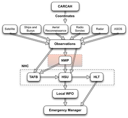
The next step in the forecast process involves analyzing all of the data gathered by the various observational platforms. The observations are examined, quality controlled, and then used to initialize a suite of hurricane forecast models, often referred to more generally as numerical prediction (NWP) models. These hurricane forecast models create objective, computer-generated predictions of a hurricane’s future track and intensity.
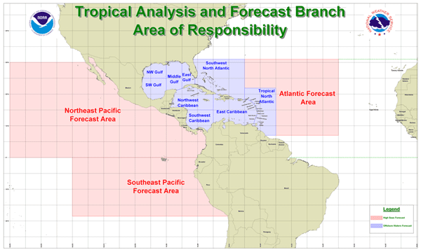
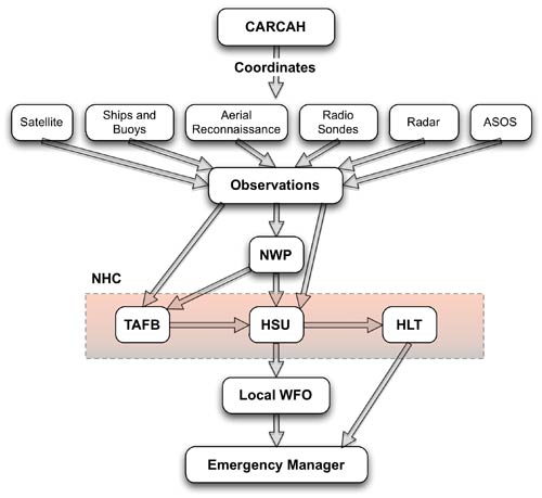
Results from hurricane forecast models (and ensembles generated from the individual models) are interpreted and then used as guidance to create official hurricane forecasts and warnings. Each model has a different way of representing atmospheric processes and will sometimes produce very different results. Therefore, forecasters must evaluate the strengths and weaknesses of each model’s output before producing their official forecast. To do this evaluation, the forecasters compare the forecast models’ results to the current and recent environmental observations. Hurricane forecasters then use their experience and judgment to decide how to use the individual and ensemble model guidance to produce the best possible forecast. Multiple units within the NHC are involved in the forecast process, including the Tropical Analysis and Forecast Branch (TAFB), Hurricane Specialists Unit (HSU), and Hurricane Liaison Team (HLT). The TAFB is comprised of a branch chief, five lead forecasters, 10 forecasters, and two meteorological interns. This unit is tasked with providing forecasts for the tropical oceans 24 hours per day, year-round, covering an area of approximately 14 million square nautical miles. They produce 57 graphic products and 48 text products each day. During the hurricane season, the TAFB and the Technical Support Branch (TSB) support the NHC by providing information such as satellite-derived tropical cyclone position and intensity estimates, as well as radar location fixes for tropical cyclones (when available).
The HSU maintains a continuous watch on tropical cyclones and areas of disturbed weather in the Atlantic and Eastern Pacific basins and analyzes information from the CARCAH and TAFB, direct and indirect environmental observations, and forecast model results. The HSU also produces the final public forecast products. Once a storm forms, a complete suite of advisory products, including text advisories and graphical forecast products, is issued every 6 hours. Additional products are issued more frequently when a hurricane watch or a hurricane warning are in place. Intermediate public advisories may be issued at 2-hour intervals when land-based radar can provide reliable fixes on a storm’s center, and tropical cyclone position estimates are issued in between these 2-hourly advisories. When a threat is imminent, NHC products provide the estimated location for a tropical cyclone each hour. A preliminary tropical cyclone report (TRC) is generated after the conclusion of each tropical cyclone, and monthly tropical weather summaries are issued by the HSU at the end of each month during the hurricane season. In total, the HSU issues an average of 700 full advisory packages per year. The HSU also provides briefings on active tropical cyclones to emergency managers and the media. It is the timely and reliable dissemination of these forecast and warning products that allows members of the public (and their local emergency managers) to make plans to secure their property and take other necessary measures to protect themselves in the days and hours prior to a hurricane (or tropical storm) landfall. The HSU also cooperates with Mexican, Central American, and Caribbean meteorological services to provide watch and warning recommendations. The HLT is a Federal Emergency Management Agency (FEMA)-sponsored team made up of federal, state, and local emergency managers, FEMA personnel, and specially trained National Weather Service (NWS) forecasters. They work to serve as a "bridge" between NHC forecasters and local emergency managers dealing with a tropical cyclone threat. One of the HLT’s main functions is to communicate the progress and threat level of a storm with appropriate federal, state, and local officials. State and/or local officials, however, make the final decisions concerning evacuations, not the HLT or the NHC.
Tropical cyclone forecasts and warnings are coordinated between the national centers and local forecast offices to provide consistency, which is important when a tropical cyclone landfall is imminent. After the NHC issues a forecast, local NWS Weather Forecast Offices (WFOs) use the information to tailor their local forecasts. The NHC cannot produce forecasts tailored to the conditions at every location on the coast, so it is important to contact your local WFO for current and predicted local effects of a hurricane. Information for local WFOs is provided to local and state emergency management, as well as the media. Emergency managers are the final decision makers in the forecast process. They are tasked with ordering evacuations, preparing the local community, and staging resources. For the general public, television, radio, the Internet, and NOAA weather radio are all outlets for important hurricane information. |
 |
Please address comments and questions to hurricane@etal.uri.edu